Schwarzatal | |
|---|---|
 Coat of arms | |
Location of Schwarzatal within Saalfeld-Rudolstadt district  | |
 Schwarzatal 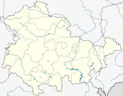 Schwarzatal | |
| Coordinates: 50°35′N 11°09′E / 50.583°N 11.150°E | |
| Country | Germany |
| State | Thuringia |
| District | Saalfeld-Rudolstadt |
| Municipal assoc. | Schwarzatal |
| Subdivisions | 9 |
| Government | |
| • Mayor (2019–25) | Kathrin Kräupner[1] (Ind.) |
| Area | |
| • Total | 25.99 km2 (10.03 sq mi) |
| Elevation | 670 m (2,200 ft) |
| Population (2022-12-31)[2] | |
| • Total | 3,393 |
| • Density | 130/km2 (340/sq mi) |
| Time zone | UTC+01:00 (CET) |
| • Summer (DST) | UTC+02:00 (CEST) |
| Postal codes | 98744, 98746 |
| Dialling codes | 036705 |
| Vehicle registration | SLF |
| Website | https://www.stadt-schwarzatal.com/ |
Schwarzatal is a town and a municipality in the district Saalfeld-Rudolstadt, in Thuringia, Germany. It was created with effect from 1 January 2019 by the merger of the former municipalities of Mellenbach-Glasbach, Meuselbach-Schwarzmühle and Oberweißbach. The name refers to the river Schwarza.
References
- ↑ Gewählte Bürgermeister - aktuelle Landesübersicht, Freistaat Thüringen, accessed 30 September 2022.
- ↑ "Bevölkerung der Gemeinden, erfüllenden Gemeinden und Verwaltungsgemeinschaften in Thüringen Gebietsstand: 31.12.2022" (in German). Thüringer Landesamt für Statistik. June 2023.
Towns and municipalities in Saalfeld-Rudolstadt | ||
|---|---|---|
Coat of arms | ||
This article is issued from Wikipedia. The text is licensed under Creative Commons - Attribution - Sharealike. Additional terms may apply for the media files.