Préneron | |
|---|---|
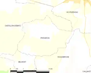
Location of Préneron | |
 Préneron  Préneron | |
| Coordinates: 43°43′39″N 0°16′40″E / 43.7275°N 0.2778°E | |
| Country | France |
| Region | Occitania |
| Department | Gers |
| Arrondissement | Auch |
| Canton | Fezensac |
| Intercommunality | Artagnan en Fézensac |
| Government | |
| • Mayor (2020–2026) | Guy Favarel[1] |
| Area 1 | 8.63 km2 (3.33 sq mi) |
| Population | 120 |
| • Density | 14/km2 (36/sq mi) |
| Time zone | UTC+01:00 (CET) |
| • Summer (DST) | UTC+02:00 (CEST) |
| INSEE/Postal code | 32332 /32190 |
| Elevation | 115–201 m (377–659 ft) (avg. 170 m or 560 ft) |
| 1 French Land Register data, which excludes lakes, ponds, glaciers > 1 km2 (0.386 sq mi or 247 acres) and river estuaries. | |
Préneron (French pronunciation: [pʁen(ə)ʁɔ̃]; Occitan: Preneron) is a commune in the Gers department in southwestern France.
Geography
Localisation
Préneron and its surrounding communes
Hydrography
The Auzoue flows north through the western part of the commune.
Population
| Year | Pop. | ±% p.a. |
|---|---|---|
| 1968 | 105 | — |
| 1975 | 113 | +1.05% |
| 1982 | 137 | +2.79% |
| 1990 | 132 | −0.46% |
| 1999 | 142 | +0.81% |
| 2009 | 143 | +0.07% |
| 2014 | 140 | −0.42% |
| 2020 | 121 | −2.40% |
| Source: INSEE[3] | ||
See also
References
- ↑ "Répertoire national des élus: les maires". data.gouv.fr, Plateforme ouverte des données publiques françaises (in French). 9 August 2021.
- ↑ "Populations légales 2021". The National Institute of Statistics and Economic Studies. 28 December 2023.
- ↑ Population en historique depuis 1968, INSEE
Wikimedia Commons has media related to Préneron.
This article is issued from Wikipedia. The text is licensed under Creative Commons - Attribution - Sharealike. Additional terms may apply for the media files.