Pop | |
|---|---|
City | |
 Pop Location in Uzbekistan | |
| Coordinates: 40°52′24.96″N 71°6′32.04″E / 40.8736000°N 71.1089000°E | |
| Country | |
| Region | Namangan Region |
| District | Pop District |
| Town status | 1980 |
| Elevation | 439 m (1,440 ft) |
| Population (2023) | |
| • Total | 30,000 |
| Time zone | UTC+5 (UZT) |
| Area code | +9986943 |
Pop (Uzbek: Pop/Поп, Russian: Пап, romanized: Pap) is a city in Namangan Region, Uzbekistan. It is the administrative center of Pop District.[1] Its population is 26,900 (2016).[2] At Pop, the Angren–Pop railway line (opened in 2016) joins the line from Kokand to Namangan.
Number of secondary schools — six (6): No. 1, No. 8, No. 23,No. 37, No. 40, No. 65, No. 67.
Number of secondary special educational institutions — three (3): boarding school No. 11, Medical college, Business college.
Pop town consists of 14 district-units:
- Kelachi
- Khamza
- Shomazor
- Olmazor
- Obod
- Tinchlik
- Khazrati bob
- Uzbekistan
- Ipak Yuli
- Dustlik
- Pakhtakor
- Alisher Navoi
- Khamid Olimjon
- Abdulla Kakhhar
References
- ↑ "Classification system of territorial units of the Republic of Uzbekistan" (in Uzbek and Russian). The State Committee of the Republic of Uzbekistan on statistics. July 2020.
- ↑ Soliyev, A.S. Shaharlar geografiyasi [Geography of cities] (PDF) (in Uzbek). p. 144.
Capital: Namangan | ||
| Districts | 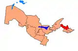 | |
| Cities | ||
| Towns | ||
This article is issued from Wikipedia. The text is licensed under Creative Commons - Attribution - Sharealike. Additional terms may apply for the media files.