| Olrik Fjord | |
|---|---|
| Kangerluarsussuaq (Greenlandic) | |
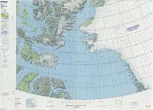 Map of Northwestern Greenland | |
 Olrik Fjord Location in Greenland | |
| Location | Arctic |
| Coordinates | 77°12′N 67°34′W / 77.200°N 67.567°W |
| Ocean/sea sources | Hvalsund Baffin Bay |
| Basin countries | Greenland |
| Max. length | 80 km (50 mi) |
| Max. width | 5 km (3.1 mi) |
| Settlements | Naajat |
Olrik Fjord (Danish: Olriks Fjord; Greenlandic: Kangerluarsussuaq) is a fjord in the Avannaata municipality, Northwestern Greenland. To the east the fjord opens into the Hvalsund, at the end of the Inglefield Gulf of the Baffin Bay.[1]
This fjord was named by Robert Peary after Christian Søren Marcus Olrik, Royal Inspector of North Greenland.[2]
Geography
Olrik Fjord runs in a roughly east–west direction with its mouth west of Kangeq, in the southern shore of the mouth of the Inglefield Gulf, where the latter becomes the Hvalsund.[3] It is a long and narrow fjord, having a shape uncommon in NW Greenland. In the area near its mouth the fjord's southern shore is fringed by up to 680 m (2,230 ft) high cliffs displaying multicolored strata.[4]
The Marie Glacier, an offshoot of the Leidy Glacier, discharges at the head of the Olrik Fjord, not far from the head of the Academy Fjord.[5][6]
.jpg.webp) 19th century map of the Inglefield Gulf. |
Bibliography
See also
References
- ↑ GoogleEarth
- ↑ Robert Neff Keely, Gwilym George Davis, In Arctic Seas: the Voyage of the Kite with the Peary Expedition, 2011 p. 373
- ↑ "Olrik Fjord". Mapcarta. Retrieved 24 April 2019.
- ↑ Prostar Sailing Directions 2005 Greenland and Iceland Enroute, p. 88
- ↑ Greenland’s Leidy Glacier; NASA Earth Observatory
- ↑ The recent regimen of the ice cap margin in North Greenland
External links
- Arctic desert, Olrik Fjord, Northern Greenland
- Some examples of dated musk-ox Ovibos moschatus finds from the Olrik Fjord area in the Thule region