| Lake Nippenicket | |
|---|---|
 Lake Nippenicket | |
 Lake Nippenicket  Lake Nippenicket | |
| Location | Plymouth and Bristol County, Massachusetts, U.S. |
| Coordinates | 41°58′19″N 71°02′28″W / 41.97194°N 71.04111°W |
| Type | Natural freshwater pond |
| Basin countries | United States |
| Surface area | 354 acres (143 ha) |
| Average depth | 3 ft (0.91 m) |
| Max. depth | 6 ft (1.8 m) |
| Surface elevation | 56 ft (17 m)[1] |
| Settlements | Bridgewater, Massachusetts |
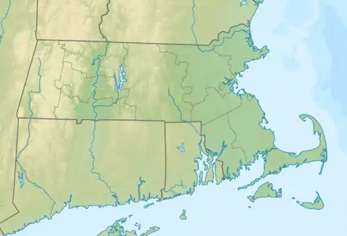
Lake Nippenicket, known locally as The Nip, is a freshwater pond in the town of Bridgewater, Massachusetts, and immediately adjacent to Raynham, Massachusetts. The lake borders a tiny portion of Route 104, and is near the junction of I-495 and Route 24. Lake Nippenicket is part of the Taunton River Watershed, emptying into the Town River and into the Taunton River, and a good-size portion of it is included with the Hockomock Swamp Wildlife Management Area. The lake is named after a Native American tribe from that area.
References
External links
This article is issued from Wikipedia. The text is licensed under Creative Commons - Attribution - Sharealike. Additional terms may apply for the media files.