Kattupalli
காட்டுபள்ளி | |
|---|---|
Suburb | |
 Kattupalli  Kattupalli | |
| Coordinates: 13°18′24″N 80°19′59″E / 13.30666°N 80.33300°E | |
| Country | India |
| State | |
| District | Tiruvallur |
| Taluk | Ponneri |
| Metro | Chennai |
| Elevation | 4 m (13 ft) |
| Population (2011) | |
| • Total | 1,911[1] |
| Languages | |
| • Official | Tamil |
| Time zone | UTC+5:30 (IST) |
| PIN | 600120 |
| Telephone code | 044-xxxx |
| Vehicle registration | TN-18-xxxx & TN-20-xxxx(old) |
| Planning agency | DTCP |
| City | Chennai |
| Lok Sabha constituency | Thiruvallur |
| Vidhan Sabha constituency | Ponneri |
Kattupalli (Tamil: காட்டுபள்ளி), is a suburb located North of Chennai, a metropolitan city in Tamil Nadu, India.
Location
Kattupalli is located in between Ennore, Pazhaverkadu and Minjur in North of Chennai. The arterial road in Kattupalli is Port access road (Ennore - Pazhaverkadu road).
Geographic Location | |
|---|---|
Seawater Desalination Plant
The Minjur seawater desalination plant in Kattupalli plays a major role of water supply in North Chennai.
Kattupalli Port
The Kattupalli Port cum Shipyard is a private complex which has a port and a ship building unit. It is third largest port in Chennai after Chennai Port and Ennore Port. There were strong opposition from people for proposal of expanding the port.[2][3]
References
- ↑ "Census of India: Kattupalli". www.censusindia.gov.in. Office of the Registrar General & Census Commissioner, India. Retrieved 22 August 2020.
- ↑ "Kattupalli Port expansion gets Centre's ToR, sparks concern". The New Indian Express. 29 July 2019. Retrieved 22 August 2020.
- ↑ "Kattupalli port expansion plan: fishermen, farmers fear loss of livelihood". The Hindu. 4 August 2019. Retrieved 22 August 2020.
External links
Areas of Chennai | |
|---|---|
| North |
|
| West |
|
| Central |
|
| South |
|
| District headquarters | 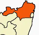 | |
|---|---|---|
| Country | ||
| State | ||
| Region | ||
| Revenue divisions | ||
| Taluks | ||
| Revenue blocks | ||
| Municipal corporations | ||
| Municipalities | ||
| Special grade town panchayats | ||
| Town panchayats | ||
| History | ||
| Places of interest |
| |
| Universities |
| |
This article is issued from Wikipedia. The text is licensed under Creative Commons - Attribution - Sharealike. Additional terms may apply for the media files.