Groessen | |
|---|---|
Village | |
 | |
 Groessen Location in the Netherlands  Groessen Groessen (Netherlands) | |
| Coordinates: 51°55′50″N 6°01′34″E / 51.9305°N 6.0261°E | |
| Country | Netherlands |
| Province | Gelderland |
| Municipality | Duiven |
| Area | |
| • Total | 9.10 km2 (3.51 sq mi) |
| Elevation | 11 m (36 ft) |
| Population (2021)[1] | |
| • Total | 1,980 |
| • Density | 220/km2 (560/sq mi) |
| Time zone | UTC+1 (CET) |
| • Summer (DST) | UTC+2 (CEST) |
| Postal code | 6923[1] |
| Dialing code | 0316 |
Groessen is a village in the municipality of Duiven in the province of Gelderland, the Netherlands.
It was first mentioned in 838 in uilla Gruosna, and means "settlement in grassland".[3] The village developed near the Rhine. The St Andreas Church was a tower from the 12th century. The church dates from around 1500, and has been enlarged in 1923.[4] In 1840, it was home to 1,406 people.[5]
Gallery
 Sint Andreaskerk
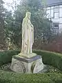 Statue of Sacred Heart of Jesus Christ
 House in Groessen
 Farm in Groessen
References
- 1 2 3 "Kerncijfers wijken en buurten 2021". Central Bureau of Statistics. Retrieved 21 March 2022.
- ↑ "Postcodetool for 6923AA". Actueel Hoogtebestand Nederland (in Dutch). Het Waterschapshuis. Retrieved 21 March 2022.
- ↑ "Groessen - (geografische naam)". Etymologiebank (in Dutch). Retrieved 22 March 2022.
- ↑ Ronald Stenvert & Sabine Broekhoven (2000). "Groessen" (in Dutch). Zwolle: Waanders. p. 183. ISBN 90 400 9406 3. Retrieved 20 March 2022.
- ↑ "Groessen". Plaatsengids (in Dutch). Retrieved 22 March 2022.
This article is issued from Wikipedia. The text is licensed under Creative Commons - Attribution - Sharealike. Additional terms may apply for the media files.