Derby, Colorado | |
|---|---|
.jpg.webp) Lower Derby Lake | |
 Location of the Derby CDP in Adams County, Colorado. | |
 Derby Location of the Derby CDP in the United States. | |
| Coordinates: 39°50′25″N 104°55′01″W / 39.8402608°N 104.9168320°W[1] | |
| Country | |
| State | |
| County | Adams County |
| Government | |
| • Type | unincorporated community |
| Area | |
| • Total | 1.6 sq mi (4.2 km2) |
| • Land | 1.6 sq mi (4.2 km2) |
| • Water | 0 sq mi (0 km2) |
| Elevation | 5,121 ft (1,561 m) |
| Population | |
| • Total | 8,407 |
| • Density | 5,300/sq mi (2,000/km2) |
| Time zone | UTC-7 (MST) |
| • Summer (DST) | UTC-6 (MDT) |
| ZIP Code[4] | Commerce City 80022 |
| Area codes | 303 & 720 |
| GNIS feature[2] | Derby CDP |
Derby is an unincorporated community and a census-designated place (CDP) located in and governed by Adams County, Colorado, United States. The CDP is a part of the Denver–Aurora–Lakewood, CO Metropolitan Statistical Area. The population of the Derby CDP was 8,407 at the United States Census 2020.[3] The Commerce City post office (Zip code 80022) serves the area.[4]
History
The Derby post office was established in 1910 and remained in operation until 1963.[5] The community is named after Derby, England.[6]
Geography
The Derby CDP has an area of 1,129 acres (4.570 km2), including 9.4 acres (0.038 km2) of water.[1]
Demographics
The United States Census Bureau initially defined the Derby CDP for the 1950 United States Census.
| Year | Pop. | ±% |
|---|---|---|
| 1950 | 2,840 | — |
| 1960 | 10,124 | +256.5% |
| 1970 | 10,206 | +0.8% |
| 1980 | 8,578 | −16.0% |
| 1990 | 6,043 | −29.6% |
| 2000 | 6,423 | +6.3% |
| 2010 | 7,685 | +19.6% |
| 2020 | 8,407 | +9.4% |
| Source: United States Census Bureau | ||
See also
References
- 1 2 3 "State of Colorado Census Designated Places - BAS20 - Data as of January 1, 2020". United States Census Bureau. Retrieved December 6, 2020.
- 1 2 3 "U.S. Board on Geographic Names: Domestic Names". United States Geological Survey. Retrieved December 6, 2020.
- 1 2 United States Census Bureau. "Derby CDP, Colorado". Retrieved April 19, 2023.
- 1 2 "Zip Code 80022 Map and Profile". zipdatamaps.com. 2020. Retrieved December 20, 2020.
- ↑ "Post offices". Jim Forte Postal History. Archived from the original on March 6, 2016. Retrieved June 25, 2016.
- ↑ Dawson, John Frank. Place names in Colorado: why 700 communities were so named, 150 of Spanish or Indian origin. Denver, CO: The J. Frank Dawson Publishing Co. p. 17.
External links
Municipalities and communities of Adams County, Colorado, United States | ||
|---|---|---|
| Cities | 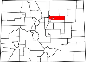 Map of Colorado highlighting Adams County | |
| Towns | ||
| CDPs | ||
| Unincorporated communities |
| |
| Footnotes | ‡This populated place also has portions in an adjacent county or counties | |
This article is issued from Wikipedia. The text is licensed under Creative Commons - Attribution - Sharealike. Additional terms may apply for the media files.