Barbuda Codrington Airport | |||||||||||
|---|---|---|---|---|---|---|---|---|---|---|---|
 | |||||||||||
| Summary | |||||||||||
| Airport type | Public | ||||||||||
| Operator | Antigua and Barbuda Airport Authority[1] | ||||||||||
| Serves | Codrington, Barbuda, Antigua and Barbuda | ||||||||||
| Elevation AMSL | 15 ft / 5 m | ||||||||||
| Coordinates | 17°38′09″N 061°49′37″W / 17.63583°N 61.82694°W | ||||||||||
| Map | |||||||||||
 BBQ Location in Barbuda | |||||||||||
| Runways | |||||||||||
| |||||||||||
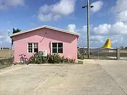
Barbuda Codrington Airport (IATA: BBQ, ICAO: TAPH) is a public airport serving the village of Codrington, on the island of Barbuda. It has a very short runway.

The interior of the airport.
In September 2017, Hurricane Irma seriously damaged Barbuda Codrington Airport, and as a result, Antiguan and Barbudan authorities shut down the airport until repairs were completed.[4]
Airlines and destinations
| Airlines | Destinations |
|---|---|
| ABM Air | Antigua |
| Anguilla Air Services | Charter: Anguilla (suspended) |
| Caribbean Helicopters | Antigua |
| FlyMontserrat | Antigua |
| St Barth Commuter | Charter: Saint Barthélemy (suspended) |
| Trans Anguilla Airways | Charter: Anguilla (suspended) |
References
- ↑ "JOB VACANCIES: Antigua & Barbuda Airport Authority". 9 December 2021.
- ↑ Airport information for Barbuda Codrington Airport at Great Circle Mapper. Source: DAFIF (effective October 2006).
- ↑ Airport information for Barbuda Codrington Airport at Transport Search website.
- ↑ Smith-Spark, Laura; Brocchetto, Marilia (8 September 2017). "Deaths reported as Hurricane Irma batters northern Caribbean islands". CNN.
External links
This article is issued from Wikipedia. The text is licensed under Creative Commons - Attribution - Sharealike. Additional terms may apply for the media files.