Bélaye | |
|---|---|
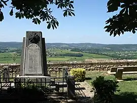 The war memorial in Bélaye | |
Location of Bélaye | |
 Bélaye  Bélaye | |
| Coordinates: 44°27′57″N 1°11′37″E / 44.4658°N 1.1936°E | |
| Country | France |
| Region | Occitania |
| Department | Lot |
| Arrondissement | Cahors |
| Canton | Luzech |
| Intercommunality | Vallée du Lot et du Vignoble |
| Government | |
| • Mayor (2020–2026) | Jacques Baijot[1] |
| Area 1 | 18.69 km2 (7.22 sq mi) |
| Population | 207 |
| • Density | 11/km2 (29/sq mi) |
| Time zone | UTC+01:00 (CET) |
| • Summer (DST) | UTC+02:00 (CEST) |
| INSEE/Postal code | 46022 /46140 |
| Elevation | 80–274 m (262–899 ft) (avg. 209 m or 686 ft) |
| 1 French Land Register data, which excludes lakes, ponds, glaciers > 1 km2 (0.386 sq mi or 247 acres) and river estuaries. | |
Bélaye (French pronunciation: [belaj]; Occitan: Belaiga) is a commune in the Lot department in southwestern France.
Population
| Year | Pop. | ±% p.a. |
|---|---|---|
| 1968 | 255 | — |
| 1975 | 228 | −1.59% |
| 1982 | 204 | −1.58% |
| 1990 | 220 | +0.95% |
| 1999 | 223 | +0.15% |
| 2009 | 216 | −0.32% |
| 2014 | 231 | +1.35% |
| 2020 | 209 | −1.65% |
| Source: INSEE[3] | ||
See also
References
- ↑ "Répertoire national des élus: les maires". data.gouv.fr, Plateforme ouverte des données publiques françaises (in French). 2 December 2020.
- ↑ "Populations légales 2021". The National Institute of Statistics and Economic Studies. 28 December 2023.
- ↑ Population en historique depuis 1968, INSEE
Wikimedia Commons has media related to Bélaye.
This article is issued from Wikipedia. The text is licensed under Creative Commons - Attribution - Sharealike. Additional terms may apply for the media files.