| Mount Shindainichi | |
|---|---|
| 新大日 | |
 Mt.Shindainichi from Mt.Karasuo | |
| Highest point | |
| Elevation | 1,340 m (4,400 ft) |
| Coordinates | 35°27′05″N 139°10′36″E / 35.45139°N 139.17667°E |
| Geography | |
| Location | Kanagawa, Japan |
| Parent range | Tanzawa Mountains |
| Climbing | |
| First ascent | unknown |
| Easiest route | Hike |
Mount Shindainichi (新大日) is a peak of the Tanzawa Mountains with an elevation of 1,340 metres (4,396 ft), and is located due east of Mount Tō. It is located within the boundary of the Tanzawa-Ōyama Quasi-National Park.
The mountain is easily accessible by a hiking trail from Yabitsu Pass, which intersects with the Nagaone Trail from the village of Kiyokawa, and with the trail leading directly to Mount Tō which is approximately a 40-minute hike.
Gallery
 Mount To, Mount Shindainichi and Mount Tanzawa from Mount Sannoto
 Mount Shindainichi from Mount Gyoja
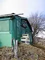 A hut on the top of Mount Shindainichi
 Odawara City and Izu Peninsula from Mount Shindainichi
Wikimedia Commons has media related to Mount Shindainichi.
This article is issued from Wikipedia. The text is licensed under Creative Commons - Attribution - Sharealike. Additional terms may apply for the media files.